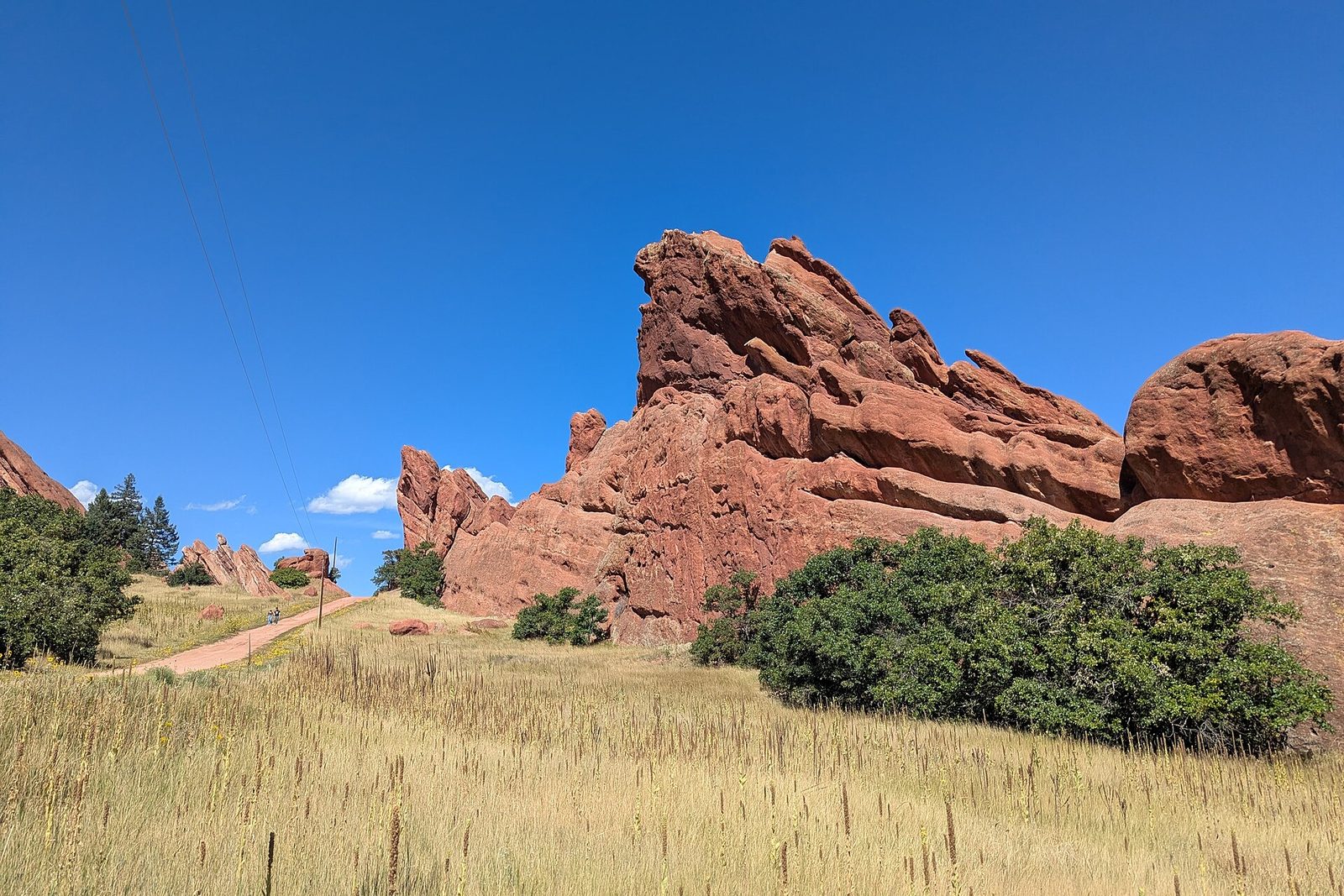
The thing that surprises visitors most about Denver is how quickly the city stops. Drive twenty-five minutes west from downtown and the grid simply ends against a wall of tilted red rock, with trailheads at the bottom of it and a hawk somewhere overhead. The best hikes near Denver are not a weekend expedition — they are a morning, and most of them are free, and a good number are reachable before the coffee has worn off. This guide covers the flat city loops, the foothills parks twenty minutes out, the state parks worth their entry fee, and the alpine trails that need a real plan. Prices and seasons checked September 2026.
One framing point. Denver sits at 5,280 feet and the trailheads in this guide run from 5,200 to over 11,000. Altitude is the single biggest variable in whether a hike here feels wonderful or wretched, and it has almost nothing to do with your fitness at home. Start low, go slowly, and save the high ones for later in your trip.
The Hikes at a Glance
| Hike | Distance | Effort | From downtown | Fee |
|---|---|---|---|---|
| Washington Park loop | About 2.6 miles | Flat | 15 min | Free |
| Rocky Mountain Arsenal NWR | Varies; also a driving loop | Flat | 25 min | Free |
| Red Rocks Trading Post Trail | 1.4-mile loop | Easy–moderate | 30 min | Free |
| Matthews/Winters & Dakota Ridge | Up to about 6 miles | Moderate | 30 min | Free |
| Mount Falcon Park | 2–7 miles depending on route | Moderate | 35 min | Free |
| North Table Mountain | About 5 miles | Moderate | 30 min | Free |
| Roxborough State Park | 2–6 miles | Easy–moderate | 40 min | $10–15 per vehicle |
| Chautauqua & Royal Arch, Boulder | About 3.4 miles | Strenuous | 50 min | Free (parking limited) |
| Herman Gulch | About 6.5 miles | Strenuous, alpine | 1 hr | Free |
| Mount Bierstadt | About 7 miles | Very strenuous, 14er | 1 hr 30 | Free |
Before You Set Off
Five things that separate a good Denver hike from a miserable one.
Altitude. A sea-level visitor should plan on roughly 70% of their normal capacity on day one, and less again above 9,000 feet. Official visitor guidance is to drink about twice your usual water, because the air is dry as well as thin, and to go easy on alcohol until you are acclimatized. Headache, breathlessness and a poor night’s sleep are all normal in the first 48 hours. Anything worse means go lower.
Afternoon storms. From roughly June to August, thunderstorms build over the Front Range almost daily and arrive around 3pm with genuine lightning. The rule everyone here follows is to be off exposed ridges and summits by noon. This is not caution; it is the single most important safety habit in Colorado hiking.
Sun. There is about 25% less atmosphere overhead than at sea level and more than 300 days of sunshine a year. Sunscreen, sunglasses and a hat, in every season, including on snow.
Parking. The popular foothills trailheads — Mount Falcon, the Table Mountains, Chautauqua in Boulder — fill by 8am on summer weekends and stay full. Arrive early or go on a weekday; there is rarely an overflow option.
Etiquette. Uphill hikers have right of way. Many of these trails are shared with mountain bikers, who should yield to you and often will not, so stay aware. Dogs are allowed on leash in most Jefferson County parks and prohibited in others, including Roxborough — check the specific park. Pack everything out, including fruit peel, and stay on the trail, because the soil here is thin and slow to recover.
In the City: Flat, Free and Better Than Expected
Denver’s urban walking is genuinely good, and on a first day at altitude it is exactly what you should be doing instead of driving into the mountains.
Washington Park has a loop of about 2.6 miles around two lakes, flower gardens and a 1913 boathouse, and it is the city’s default run. It is not wilderness; it is a very pleasant hour and the best place in Denver to see how the city uses its outdoors.
City Park is larger and less manicured, with the Denver Museum of Nature & Science on its east side and the single best free view in the city — downtown framed against the entire Front Range from the west shore of Ferril Lake.
The Cherry Creek and South Platte River trails form a continuous traffic-free spine from Confluence Park downtown out through Cherry Creek and beyond, paved and flat, and are the reason Denver is a better cycling city than a driving one. The High Line Canal, a 19th-century irrigation ditch turned 71-mile trail, threads through the southern suburbs under old cottonwoods and is a genuinely strange, lovely walk.
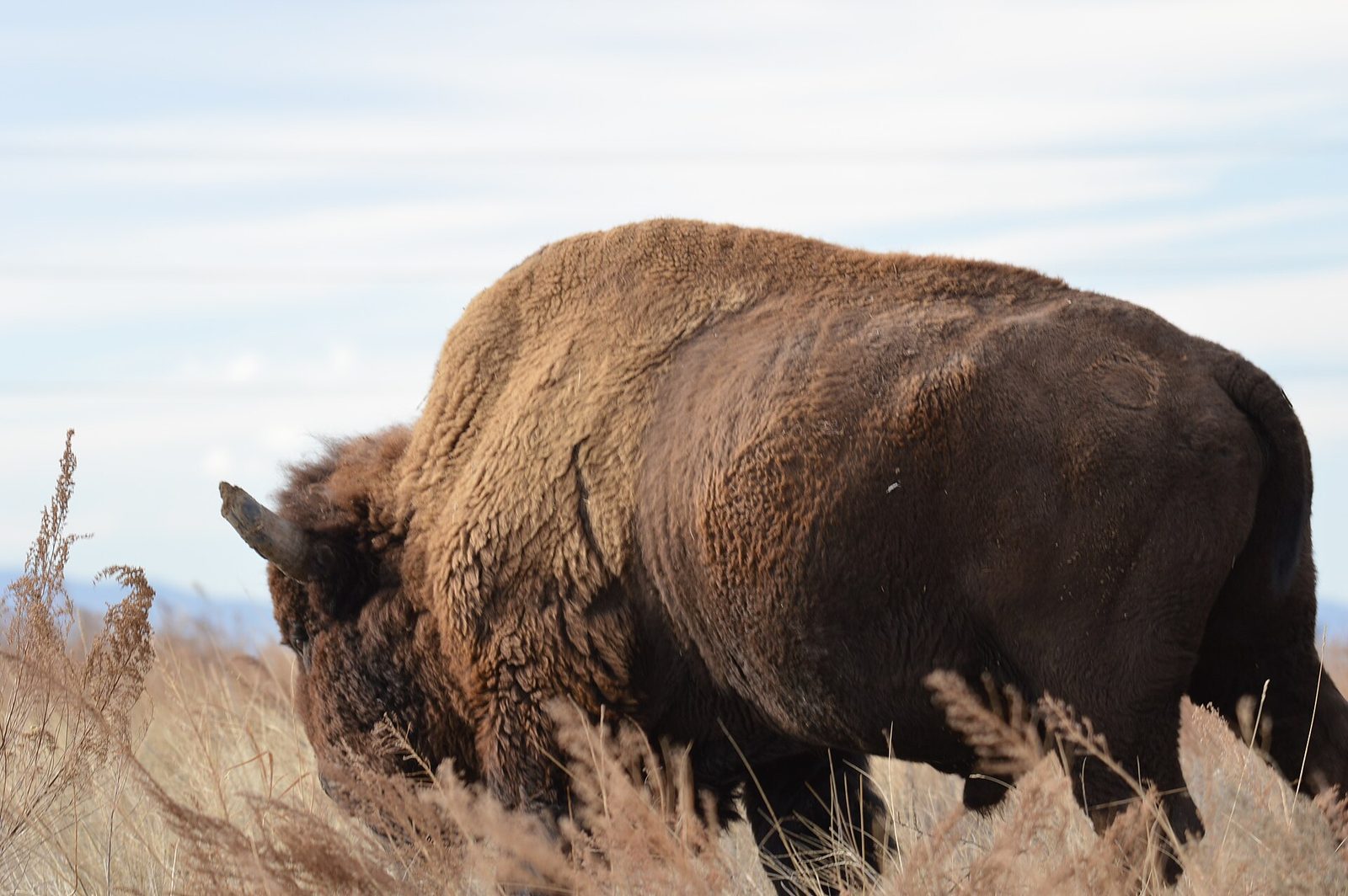
The best of them, though, is the Rocky Mountain Arsenal National Wildlife Refuge, twenty-five minutes northeast. A former chemical weapons manufacturing site, cleaned up over decades and now 15,000 acres of short-grass prairie with a bison herd, deer, raptors and a driving loop with trails off it. Admission is free. You can stand on the plains, watch bison graze, and see the downtown skyline on the horizon with the mountains behind it — a combination available nowhere else in urban America.
The Foothills: Twenty to Forty Minutes Out
Jefferson County’s open space parks form a ring of trailheads along the first wall of the Front Range, and — this is the important part — they are free, with free parking. This is where most Denver residents actually hike.
Mount Falcon Park
Above Morrison, with two entrances: an upper one that gives you easy access to the ruins of John Brisben Walker’s burned-out stone castle and a view straight down onto Red Rocks, and a lower one that makes you climb 1,700 feet to reach the same place. Routes run from two to seven miles. The upper lot is the family option; the lower is a proper workout. Walker also built the foundations of a never-completed “summer White House” up here, which is still visible and still faintly absurd.
Matthews/Winters Park and Dakota Ridge
Directly across I-70 from Red Rocks, and the connection matters: the Red Rocks Trail runs from here into the park itself, making a loop of up to about six miles possible. The Dakota Ridge trail runs along the hogback on the east side with continuous views over the plains, and it links to Dinosaur Ridge and its fossil tracks.
North and South Table Mountain
The two flat-topped mesas above Golden, capped with basalt from ancient lava flows. North Table is the more developed, with a loop of about five miles and a steady climb to a plateau that feels much further from the city than it is. Exposed and hot in summer; superb in October.
Apex, Mount Galbraith and Green Mountain
Apex Park in Golden climbs a shaded canyon and is popular with mountain bikers, who have designated days on some sections. Mount Galbraith is a steeper, quieter loop with a summit view over Golden. Green Mountain, inside Lakewood city limits, is the most accessible foothills climb of all — a bare grassy hill with a panoramic top and a trailhead you can reach by bus.
Lair o’ the Bear and Deer Creek Canyon
Lair o’ the Bear, in Bear Creek Canyon near Idaho Springs Road, is flat, shaded and follows a creek, which makes it the best foothills option with small children or on a hot afternoon. Deer Creek Canyon, further south, is steeper and drier with long views back over the southern suburbs.
Red Rocks and Dinosaur Ridge
The most famous rock formation near Denver is also a hiking destination. The Trading Post Trail is a 1.4-mile loop through the formations, with uneven footing and a few hundred feet of elevation change, and the amphitheatre steps themselves function as the region’s most scenic stair workout. Access and parking are free on any day without a concert — the details are in our Red Rocks guide, including the show-day closures that catch people out.
Two miles away on the Alameda Parkway hogback, Dinosaur Ridge exposes dinosaur tracks and bones in a road cut. It is a short walk rather than a hike, and it is one of the more remarkable roadside fossil sites in the country.
State Parks Worth the Entry Fee
Colorado’s state parks charge a daily vehicle pass of $10 to $15 depending on the park; the self-serve daily pass is $10 and runs until noon the following day. Colorado residents can buy the Keep Colorado Wild Pass for $29 when registering a vehicle. For a visitor, one or two of these is worth paying for.
Roxborough State Park
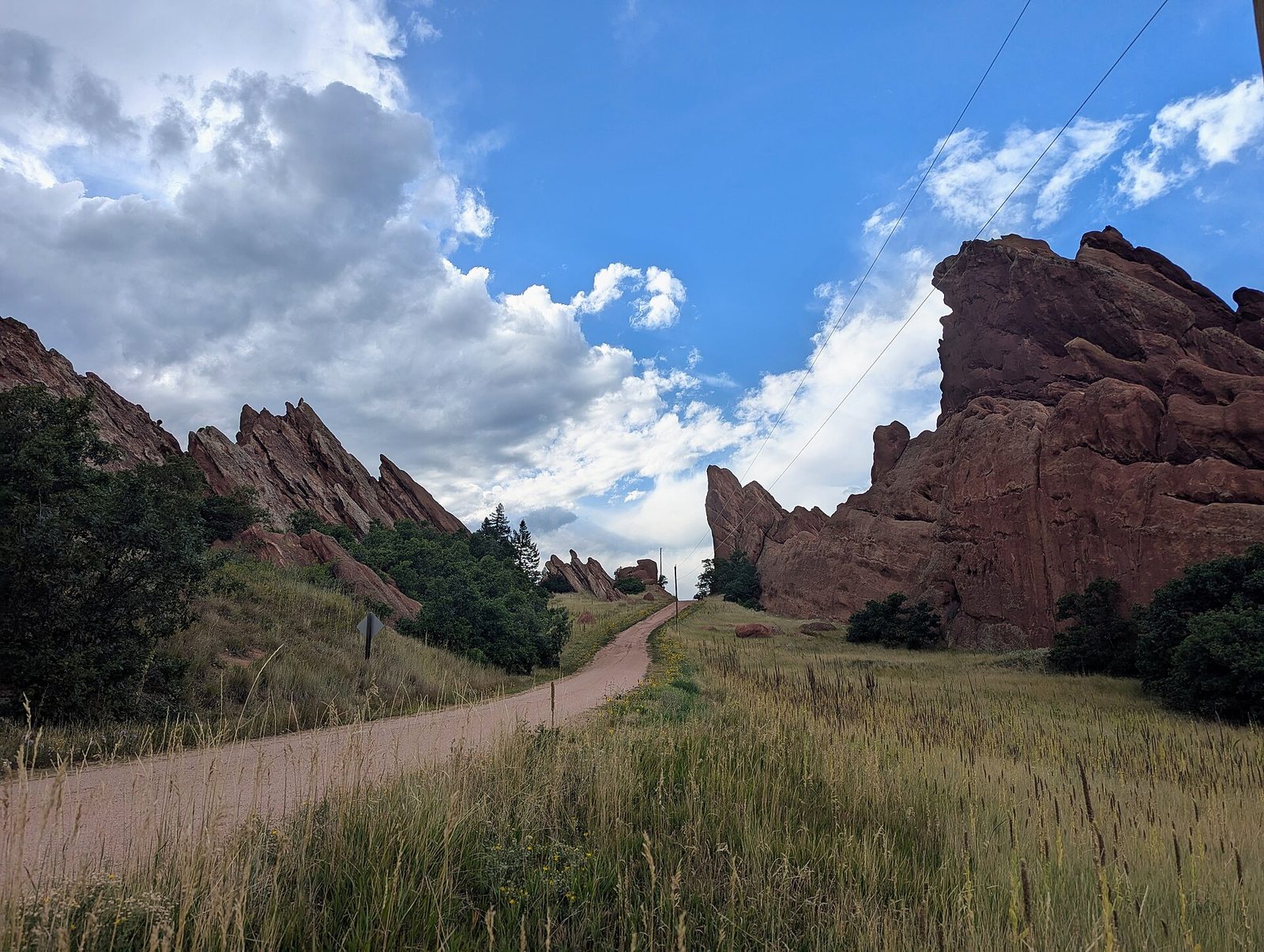
The pick of them. Forty minutes south of the city, Roxborough holds the same upended red sandstone as Red Rocks but without a concert venue in the middle of it — fins and spires of Fountain Formation rock rising straight out of prairie grass, with trails threading between them. The Fountain Valley Trail is an easy two-and-a-bit miles; the Carpenter Peak trail is a proper six-mile climb with a summit view over the whole Front Range.
Two rules here: no dogs at all, and no bikes, both to protect the wildlife. Rattlesnakes and black bears both live in the park, which is worth knowing rather than worrying about. It is the most beautiful hiking within an hour of Denver, and the quietest for what it is.
Castlewood Canyon, Staunton and Golden Gate Canyon
Castlewood Canyon, southeast near Franktown, is a surprise: a genuine canyon cut into the plains, with the ruins of a dam that failed catastrophically in 1933 and sent a flood down Cherry Creek into Denver. Easy trails, few crowds.
Staunton State Park, an hour southwest off US 285, is the newest of them and the most varied — granite outcrops, a waterfall, meadows and a good network of trails in the 8,000-foot pine country.
Golden Gate Canyon State Park, above Golden, climbs to over 10,000 feet with the Panorama Point overlook giving one of the best Continental Divide views accessible by car anywhere near Denver. Superb in late September for aspens.
Boulder’s Trails
Boulder takes its open space more seriously than almost any city in America, and the result is an extraordinary trail network beginning at the edge of town — reachable in 45 minutes by car or about 55 minutes on the Flatiron Flyer bus from Union Station.
Chautauqua Park is the gateway: a meadow at the foot of the Flatirons with trailheads running straight into them. The Royal Arch trail climbs about 1,400 feet over roughly three and a half miles round trip to a natural sandstone arch, and it is genuinely hard in the last half mile. The Chautauqua Trail and Bluebell-Baird loops are gentler alternatives with the same setting.
Mount Sanitas, closer to downtown Boulder, is a steep loop of about three miles with a rocky ridge and a view over the whole valley — the local test-piece, and busy accordingly.
Parking at Chautauqua fills very early on summer weekends and a free seasonal shuttle runs from town; use it rather than circling.
Going Higher: The Alpine Trails
An hour up I-70 the trailheads start above 10,000 feet, and the hiking changes character entirely — krummholz, tundra, snowfields into July, and weather that turns in minutes.
Herman Gulch, at exit 218 on I-70, is the classic introduction: about six and a half miles round trip up a valley to an alpine lake, through some of the best wildflower meadows in the Front Range in early July. Free, well marked, and busy on weekends.
St. Mary’s Glacier, near Idaho Springs, is a short, steep, rocky mile and a half to a permanent snowfield and lake. It is heavily visited, the parking is privately run and charged, and the trail is rougher than its distance suggests. Go for the novelty of a snowfield in August.
Mount Goliath, on the Mount Blue Sky road, protects a grove of bristlecone pines over 1,600 years old, with a short interpretive trail among them. The road access is seasonal and needs the same timed-entry permit as the summit.
Hiking a 14er From Denver
Colorado’s 14,000-foot peaks are the state’s great hiking draw, and Mount Bierstadt, reached from the top of Guanella Pass above Georgetown, is the closest and most accessible to Denver — about seven miles round trip with roughly 2,850 feet of climb, on a clear trail with no technical scrambling.
Accessible does not mean easy. Honest expectations:
- Start at dawn. Summit by 11am and be heading down before noon, because of the afternoon lightning pattern. That usually means leaving Denver by 4am.
- Acclimatize first. Do not attempt this on day one or two of a trip from sea level. Spend a few days in Denver and do something at 9,000 or 10,000 feet first.
- Expect it to take four to seven hours, and expect the last thousand feet to feel disproportionate — at 14,000 feet there is roughly 40% less oxygen than at sea level.
- Carry more than you think: three liters of water, warm layers, a waterproof, food, sun protection and a headlamp.
- Parking at Guanella Pass fills before sunrise on summer weekends, and the pass road is closed in winter.
If that sounds like more commitment than your trip allows, it probably is, and there is no shame in it. A foothills hike with a view of a dozen 14ers is a better morning than a 14er you were not ready for.
What You Are Actually Walking On
The geology here is unusually legible, and understanding it makes the hikes better — because the same three layers explain Red Rocks, Roxborough, the Flatirons and the Table Mountains, and you can watch them repeat as you drive along the foothills.
Nearest the mountains stands the Fountain Formation: coarse red sandstone laid down around 290 million years ago at the foot of the Ancestral Rockies, a range that rose and eroded away entirely before the current Rockies existed. When the modern mountains were pushed up starting about 70 million years ago, these flat layers were levered up on edge. Every dramatic red fin near Denver — Red Rocks, Roxborough, the Flatirons above Boulder, Garden of the Gods further south — is the same tilted formation, exposed at intervals along a single line.
East of it lies the Dakota Hogback, a harder, younger sandstone ridge that runs almost unbroken from Wyoming to New Mexico. It is the long, low spine you cross on I-70 just before Morrison, and it carries the dinosaur tracks at Dinosaur Ridge, laid down on a Cretaceous shoreline.
Then the plains, which are the eroded debris of the mountains themselves, thousands of feet deep. The flat-topped Table Mountains at Golden are the exception — capped by lava flows tough enough to survive while the softer rock around them washed away.
The practical value of knowing this is that it tells you what a trail will be like before you walk it. Fountain Formation means steep, red, exposed and often loose. Hogback means a narrow ridge with big views and no shade. Plains and creek bottoms mean flat, shaded cottonwood walking. Above about 9,000 feet you leave all of it behind for granite and gneiss, and the character changes again.
Wildflowers, Aspens and When to See Them
Two natural events are worth planning a hike around.
Alpine wildflowers peak in the high meadows in early to mid July, a few weeks after the snow leaves. Herman Gulch, the Guanella Pass area and the meadows on the Mount Blue Sky road are the reliable places, and the display is short, intense and worth rearranging a day for. Lower foothills flowers run earlier, from May.
Aspens turn from about the third week of September through the first week of October, working down from high elevations. Golden Gate Canyon State Park, Guanella Pass and Kenosha Pass on US 285 are the classic walks. Two pieces of practical advice: go midweek, because the aspen weekends are genuinely congested, and go higher earlier in the season and lower later, because the color descends.
A third, smaller pleasure: the bristlecone pines on Mount Goliath, on the Mount Blue Sky road, include trees over 1,600 years old, twisted into shapes by the wind at treeline. The interpretive trail among them is short and the access is seasonal.
Season by Season
Spring, March to May, is the trickiest. Foothills trails thaw and turn to mud, March is often the snowiest month in Denver, and anything above 9,000 feet is still under snow. Stick to the plains and the lower foothills, and expect at least one trail to be a bog.
Summer, June to August, opens everything. Wildflowers peak in the alpine meadows in early July. The costs are heat on the exposed foothills trails, crowded trailheads and the daily afternoon storm. Start at sunrise and you avoid all three.
Fall, September to October, is the best hiking season here by a distance. Cool air, stable weather, no bugs, and aspens turning gold from late September in the high country. Golden Gate Canyon, Guanella Pass and the Mount Blue Sky road are the classic aspen walks.
Winter, November to February, is underrated. Foothills trails are often clear and dry on south-facing slopes, the crowds vanish, and microspikes handle the icy sections. The Table Mountains, Green Mountain and Matthews/Winters all work well in winter. High-country trails need snowshoes and avalanche awareness, which is a different sport.
What Gets Overrated
- Bagging a 14er on a short trip. The famous ones are a full day, an early start and a real acclimatization requirement. Most visitors who attempt one on day two have a bad time.
- St. Mary’s Glacier on a summer weekend. Queues on a rocky trail, paid parking and a snowfield that has been photographed a million times. Go on a Tuesday or not at all.
- Chautauqua without a plan. Arriving at 10am on a Saturday and circling for parking is a widely shared Boulder experience. Take the shuttle.
- Driving two hours for a trail you could match in thirty minutes. The foothills parks are genuinely excellent and almost all free. Save the long drives for Roxborough or the alpine trails, which are actually different.
- Underestimating a “short” hike. A two-mile trail at 10,000 feet with 1,200 feet of climb is not a two-mile walk. Read the elevation profile, not the distance.
Four Hikes for Four Kinds of Visitor
If the list above is too long, take one of these and stop reading.
You landed yesterday and want to move. Washington Park loop, 2.6 flat miles at city elevation, fifteen minutes from downtown, free. Follow it with lunch on South Pearl Street. This is the right answer far more often than visitors believe.
You have a car and one free morning. Mount Falcon Park from the upper lot, thirty-five minutes out and free — castle ruins, a view down onto Red Rocks, and routes short enough to finish before the day heats up. Add the Red Rocks Trading Post loop on the way back and you have a complete foothills morning by noon.
You want the most beautiful thing within an hour. Roxborough State Park, $10 to $15 per vehicle. Fountain Valley Trail if you want two easy miles among the fins, Carpenter Peak if you want six hard ones and a summit. No dogs, no bikes, very few people.
You have a full day and real mountain ambitions. Herman Gulch at I-70 exit 218 — about six and a half miles round trip to an alpine lake, free, spectacular in early July, and a genuine high-country day without the 4am start and acclimatization demands of a 14er.
Hiking Without a Car
Most of this page needs a rental, but not all of it.
The city trails — Washington Park, City Park, the Cherry Creek and Platte trails, Sloan’s Lake — are all reachable on foot, by bus or on a rented bike from downtown.
Boulder is the one real mountain option: the Flatiron Flyer from Union Station takes about 55 minutes, and a local bus or the seasonal shuttle continues to Chautauqua. A complete car-free hiking day.
Green Mountain in Lakewood is reachable by RTD bus with a walk at the end, which makes it the most accessible foothills summit without a car.
Everything else — Red Rocks, the Jefferson County parks, the state parks, the alpine trailheads — has no scheduled transit. Our day trips guide covers how to fit a single rental day into a trip that otherwise does not need one.
Frequently Asked Questions
What is the best hike near Denver?
For most visitors, Mount Falcon Park — free, thirty-five minutes out, with castle ruins, a view over Red Rocks and routes from two to seven miles. For something more spectacular, Roxborough State Park at $10 to $15 per vehicle. For a first day at altitude, the Washington Park loop in the city.
Do I need to pay to hike near Denver?
Usually not. Jefferson County’s open space parks — Mount Falcon, Matthews/Winters, the Table Mountains, Apex, Lair o’ the Bear, Deer Creek Canyon — are free with free parking, as are Red Rocks on non-event days, Boulder’s open space and the Rocky Mountain Arsenal refuge. Colorado state parks charge $10 to $15 per vehicle per day.
How does the altitude affect hiking in Denver?
Substantially, and it is not about fitness. Plan on roughly 70% of your normal capacity on the first day, drink about twice your usual water because the air is dry as well as thin, and save anything above 10,000 feet for later in your trip. Headache and breathlessness in the first 48 hours are normal; anything worse means descend. This is general visitor guidance, not medical advice.
Can I hike a 14er as a day trip from Denver?
Mount Bierstadt, from the top of Guanella Pass, is the realistic option — about seven miles round trip and 2,850 feet of climb, with a 4am departure from the city to summit before the afternoon storms. It needs prior acclimatization and proper gear. Attempting it in your first two days in Colorado is how people end up being helped down.
When is the best time of year to hike near Denver?
September and early October: stable weather, cool air, no insects and aspens turning in the high country. Summer works if you start at sunrise and are off exposed ground by noon. Winter is surprisingly good on south-facing foothills trails. Spring is the weakest season, with mud low down and snow high up.
Are there bears, snakes or mountain lions on these trails?
Yes to all three, and encounters are rare. Rattlesnakes live in the lower foothills and at Roxborough, so watch where you put your hands and feet on warm rock. Black bears are present in the foothills and want your food, not you. Mountain lions exist and are almost never seen. Hike in company where you can, make noise on blind corners, and do not run from anything.
Can I bring a dog hiking near Denver?
In most Jefferson County parks, yes, on a leash. Boulder’s open space has its own rules including a voice-and-sight tag program. Roxborough State Park bans dogs entirely, as do some other wildlife-sensitive areas, and dogs are not allowed inside Red Rocks Amphitheatre although they are permitted on the park trails. Check the specific park before you set out.
The short lake hikes off Bear Lake Road in Rocky Mountain National Park, to Nymph, Dream and Emerald lakes or around Bear Lake itself, are among the most rewarding in Colorado, but they start near 9,500 feet and need a timed entry permit in season. Our guide to Rocky Mountain National Park from Denver covers how to get there, where to park and how to plan around the afternoon storms.
Related Denver Guides
- Red Rocks Amphitheatre: The Free Visit and the Concert Night — the Trading Post Trail and the stair workout.
- Day Trips from Denver: What Works, What Doesn’t, and When — the drives that these trailheads sit on, and the loops worth doing.
- Denver Neighborhoods: A Guide to the City Beyond Downtown — Washington Park, City Park and the trail network that connects them.
- Denver Itinerary: How to Plan One to Five Days in the City — where a hiking morning fits, and why not on day one.
Photo Credits
Roxborough State Park: photos by Sdkb / Wikimedia Commons (CC BY-SA 4.0) and Sdkb / Wikimedia Commons (CC BY-SA 4.0)
Bison at Rocky Mountain Arsenal National Wildlife Refuge: photo by USFWS Mountain-Prairie / Wikimedia Commons (CC BY 2.0)
Park fees were checked against Colorado Parks and Wildlife in September 2026. Trail distances and elevation gains are approximate and vary by route; check a current trail source and the managing agency’s page for closures, dog rules and conditions before you set out.
Denver Tourism Guide is an independent publication. We are not affiliated with VISIT DENVER, the City and County of Denver or any attraction listed here.